WHAT IS LINKING LANDS ALLIANCE?
LLA’s Original Ten Towns, mapping completed in 2010
Linking Lands Alliance (LLA) began as a grassroots, collaborative group of community members from ten Vermont Upper Valley towns working to address natural resource issues that transcend town borders.
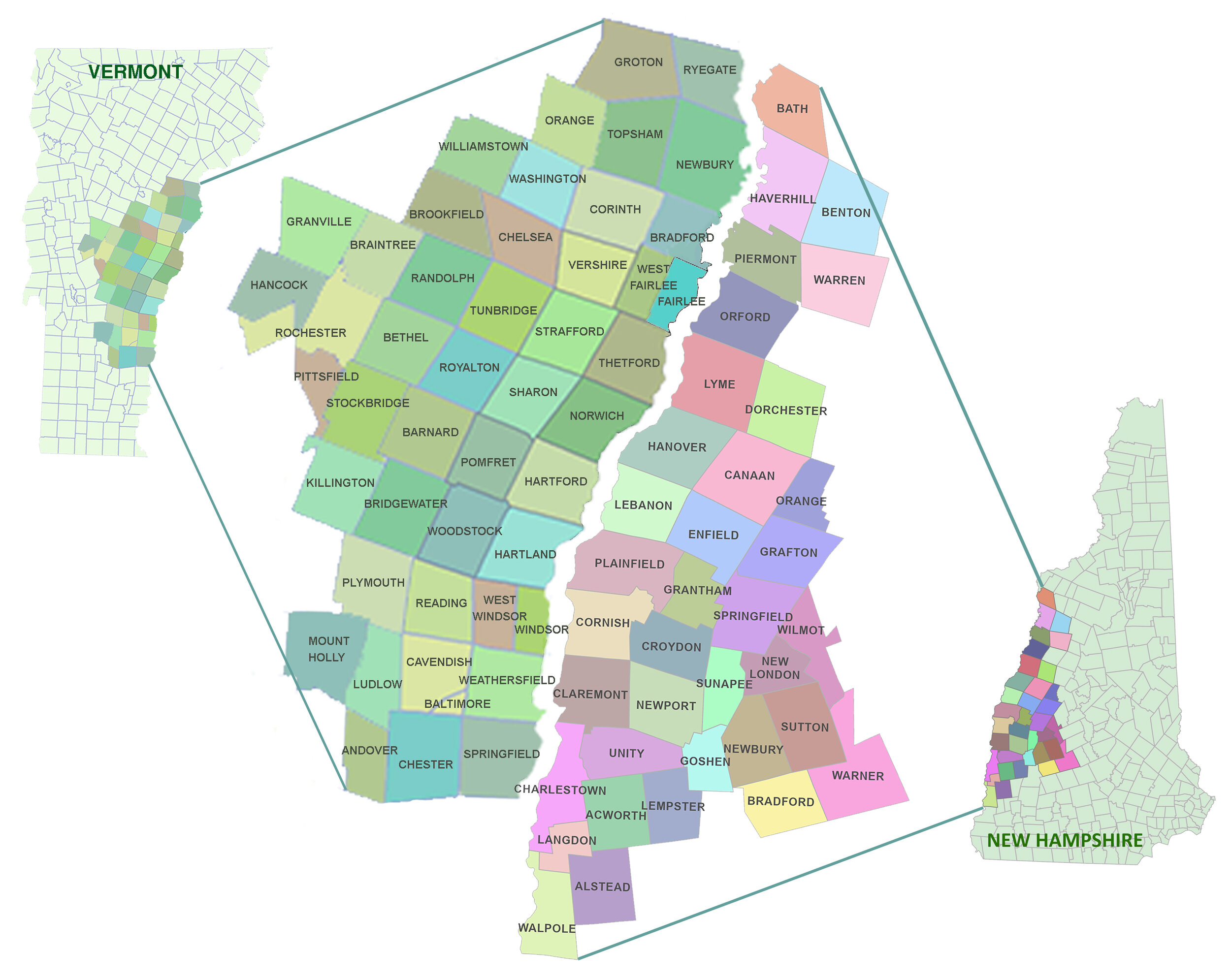
LLA is still a grassroots, collaborative group of community members but we have expanded. Our place-based maps and educational resources are now available for 47 Vermont towns and 36 New Hampshire Towns.
Vermont and New Hampshire are rich in wildlife and natural beauty. As our population continues to grow, protecting natural areas and working landscapes becomes essential to our continued enjoyment of Vermont’s natural assets.
LLA expanded to 47 Vermont Towns in 2020
LLA expanded 36 New Hampshire Towns in 2021
LLA’S WILDLIFE INITIATIVE
LLA’s first project focused on identifying important natural habitats and connecting lands that support our region’s large, wide-ranging wildlife species. Native black bear, bobcat, fisher and moose require huge acreages, often spanning two or more towns, to find food, shelter and successfully rear their young.
By identifying and protecting habitats and travel corridors vital to these animals we can also help ensure the ecological health of a multitude of other plants and animals that make up the valley’s natural diversity and beauty. LLA partnered with the Community Wildlife Program of the VT Dept. of Fish and Wildlife to develop habitat maps in our ten towns.
DEVELOPING THE WILDLIFE INITIATIVE MAPS
The first component of the initiative drew upon the extensive knowledge of state and local wildlife experts to identify and assess natural areas and features representing a broad range of habitat types and sizes within the region, including large land tracts supporting bobcat and other far-roaming species.
The second component sought input from local townspeople to identify the special places in their town they value for outdoor recreational opportunities, aesthetics, or to experience unspoiled nature and quiet solitude.
Having maps of wildlife habitat across the region allows residents to visually assess natural areas important to both wildlife and themselves and provides a starting point for stimulating neighbor-to-neighbor and inter-town dialogue that encourages good land stewardship and protection of significant wildlife habitat. It is also hoped that the natural areas and habitat connectivity maps will serve as tools to help guide land use in the Upper Valley.
Vermont Community Wildlife Program
LLA Regional Maps: Thanks to Jens Hawkins-Hilke, Conservation Planning Biologist and Scientist Team.


